
City heat isn’t just “the weather.” Urban heat islands and microclimates can make neighborhoods feel significantly hotter than regional forecasts — especially on pavement in direct sun. Here’s how to pack smarter.
Why Cities Can Feel Hotter Than the Forecast
Forecasts are useful, but they often don’t reflect what you actually experience walking on pavement, moving between buildings, or standing away from trees. A regional temperature reading is typically taken at a weather station — not at street level in the middle of a dense urban block in direct afternoon sun.
Two concepts explain the gap between the forecast and the felt temperature: urban heat islands and microclimates.
What Is an Urban Heat Island?
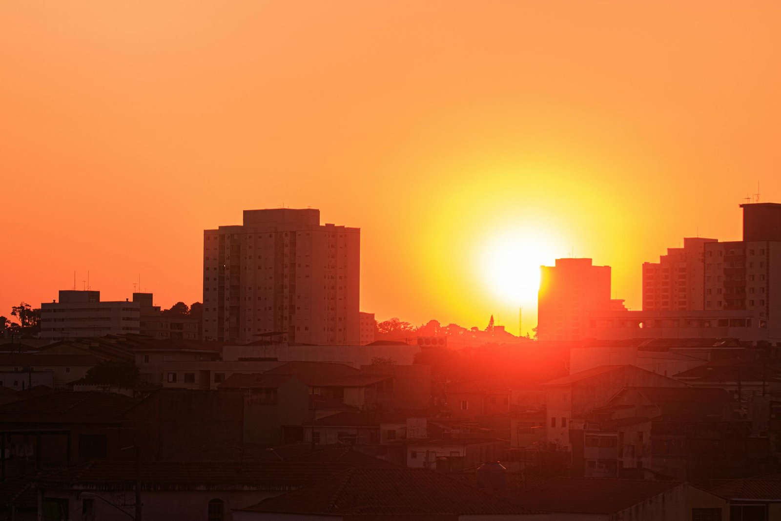
Urban heat islands occur when developed areas experience higher temperatures than nearby rural or vegetated areas. The cause is primarily physical: built environments absorb and retain heat differently than natural landscapes.
Hard surfaces — concrete, asphalt, dark roofing materials — absorb solar radiation during the day and release it slowly overnight. The reduction in vegetation means less shade and less cooling through evapotranspiration. The result is a city that runs warmer than the surrounding countryside, sometimes significantly so.
Temperatures can also vary considerably inside a city, creating hotter and cooler zones depending on building density, pavement coverage, and the presence or absence of greenery.
| 📍 Key insight for travelers |
| The same city can have meaningfully different temperature zones depending on neighborhood. A shaded historic district with narrow streets and stone buildings may feel noticeably cooler than a modern downtown block with wide open plazas and glass towers reflecting heat. |
| Your itinerary moves you through these zones — which is why a single “average temperature” figure can significantly underrepresent what you’ll actually experience. |
What Are Microclimates (and Why Travelers Should Care)?
Microclimates are localized variations in conditions that differ from the broader regional environment. Cities naturally create them. You’ll encounter them constantly without necessarily having a name for the phenomenon:
- Shaded parks and tree-lined streets that feel genuinely cooler
- Open plazas and wide boulevards where sun and reflected heat create an outdoor oven effect
- Wind corridors between tall buildings that make certain blocks feel noticeably cooler — or turn umbrellas inside out
- Heat-trapping canyon streets where tall buildings on both sides block wind and trap heat at street level
- Waterfront areas with cooling breezes that can feel dramatically different from blocks just inland
Your itinerary moves you through all of these zones in a single day. The “average temperature” for the city doesn’t capture that range.
The Traveler Mistake: Packing for the Region Instead of the Experience
The most common heat-related packing mistake isn’t dramatic — it’s just that travelers use a regional forecast as their packing reference point when they should be using their actual itinerary.
A forecast might be accurate for the metro area average. But travel comfort depends on where you walk, when you walk, how exposed those routes are, and how long you spend in sun-exposed areas without shade or cooling.
The practical rule: pack for the hottest realistic exposure window you’ll face, not for the average. If your itinerary includes midday outdoor walking in a low-shade neighborhood, plan around that — not around the morning temperature when you checked the app.
Packing Implications for City Travelers
1. Fabric Choice Matters More Than Temperature Alone
When heat is amplified by pavement and reflected sun, how your clothing manages moisture and breathability matters as much as the temperature number. Breathable, moisture-wicking fabrics maintain comfort in conditions where denser materials quickly become uncomfortable — even at moderate temperatures.
2. Shade Strategy Changes What You Need
Midday outdoor plans in low-shade areas shift your packing priorities significantly toward sun protection and cooling comfort: UV-protective fabrics or layers, a packable hat, sunscreen accessible in your bag. The same afternoon spent in a shaded historic quarter may require very little of this.
3. Warm Nights Can Persist Longer Than Expected
Urban heat islands don’t reset at sunset. Cities that hold heat overnight can feel uncomfortably warm well into the evening and early morning hours. If you’re traveling somewhere with dense urban development and limited overnight cooling, check accommodation ventilation and air conditioning before arrival — not after a warm, sleepless first night.
4. Footwear Is Part of Heat Management
Hot pavement combined with high walking volume creates specific demands on footwear. Supportive shoes that can handle long distances without discomfort, with materials that don’t trap heat excessively, matter more in urban summer travel than many travelers anticipate. This is especially true for cobblestone or uneven historic city surfaces where thin-soled footwear becomes a problem quickly.
5. Hydration Is Baseline Readiness, Not Optional
Urban exploration combines movement, direct sun exposure, and reflected heat from surrounding surfaces. The combined effect on hydration is greater than any single factor alone. Treat hydration as a non-negotiable baseline: carry water, know where refill points are, and don’t rely on thirst as the primary signal to drink.
A Simple City Microclimate Planning Framework
Before packing for any city trip in warm conditions, run through these four questions:
- What is the environment? Dense downtown, open waterfront, historic core with narrow lanes, park-heavy residential zones. Each creates a different heat profile.
- What are my exposure windows? Midday outdoor walking vs. mornings and evenings. Indoor-heavy days vs. outdoor-heavy days. Museum days vs. walking tour days.
- What is the worst realistic zone I’ll face? Pack for that — not the regional average. If one afternoon involves a long walk across an exposed plaza at peak heat, that’s your packing reference.
- Do I have adjustable layers? Shade-to-sun and indoor-to-outdoor transitions happen constantly in cities. Packable, adjustable layers that work for both are more practical than a single outfit calibrated to the average.
The Core Takeaway
Urban heat is a function of surfaces, shade, sun angle, and density — not just the regional temperature. The weather app gives you useful information. Your itinerary tells you whether the conditions you’ll actually experience match that number.
Travelers who pack for their actual exposure windows — instead of the forecast average — arrive more prepared and stay more comfortable.
FAQ: Urban Heat Islands & Travel Packing
Q: Why does a city feel hotter than the weather app forecast?
Cities can run warmer than nearby vegetated or rural areas due to heat-absorbing surfaces and reduced cooling from greenery — a phenomenon known as the urban heat island effect. Within a city, neighborhoods also differ based on shade, pavement coverage, and building density, creating microclimates that the regional forecast doesn’t capture.
Q: How much hotter can urban heat islands be?
Under certain conditions, highly developed areas can be noticeably warmer than surrounding vegetated areas. The exact difference varies by city, neighborhood, building density, and time of day, but the effect can be significant — particularly in sun-exposed areas with little shade or greenery.
Q: How should I pack differently for city microclimates?
Pack for exposure, not the average. Bring breathable fabrics, plan for sun-to-shade transitions with adjustable layers, and treat hydration as a baseline rather than an afterthought. If your itinerary includes midday outdoor time in a low-shade area, pack as if it will be hot — because on pavement in direct sun, it will be.
Q: Do parks and tree-lined areas really feel cooler?
Often yes. Green spaces provide shade and evaporative cooling effects that reduce perceived heat compared to paved, low-shade blocks. This is one reason temperature can vary meaningfully between neighborhoods in the same city on the same day.
Q: What’s the easiest way to avoid being underpacked for heat?
Use your itinerary as your reference, not the forecast. Identify midday outdoor plans and low-shade areas, then pack for the hottest realistic window you’ll face. This prevents the common “the forecast said it would be fine” surprise that catches travelers off guard.
Official and Authoritative Sources
- U.S. EPA: What Are Heat Islands?. https://www.epa.gov/heatislands/what-are-heat-islands
- U.S. EPA: Heat Island Effect (overview). https://www.epa.gov/heatislands
- Heat.gov: Urban Heat Islands. https://heat.gov/urban-heat-islands/
- UCAR: Urban Heat Islands (educational). https://scied.ucar.edu/learning-zone/climate-change-impacts/urban-heat-islands
- NASA: What Is an Urban Heat Island?. https://science.nasa.gov/kids/earth/what-is-an-urban-heat-island/
- World Meteorological Organization: Urban Heat Island Overview. https://community.wmo.int/urban-heat-island
- U.S. EPA: Reducing Urban Heat Islands (Compendium, Ch. 1). https://www.epa.gov/sites/production/files/2017-05/documents/reducing_urban_heat_islands_ch_1.pdf